Ramsar
A window into some of the projects I lead or contribute to.
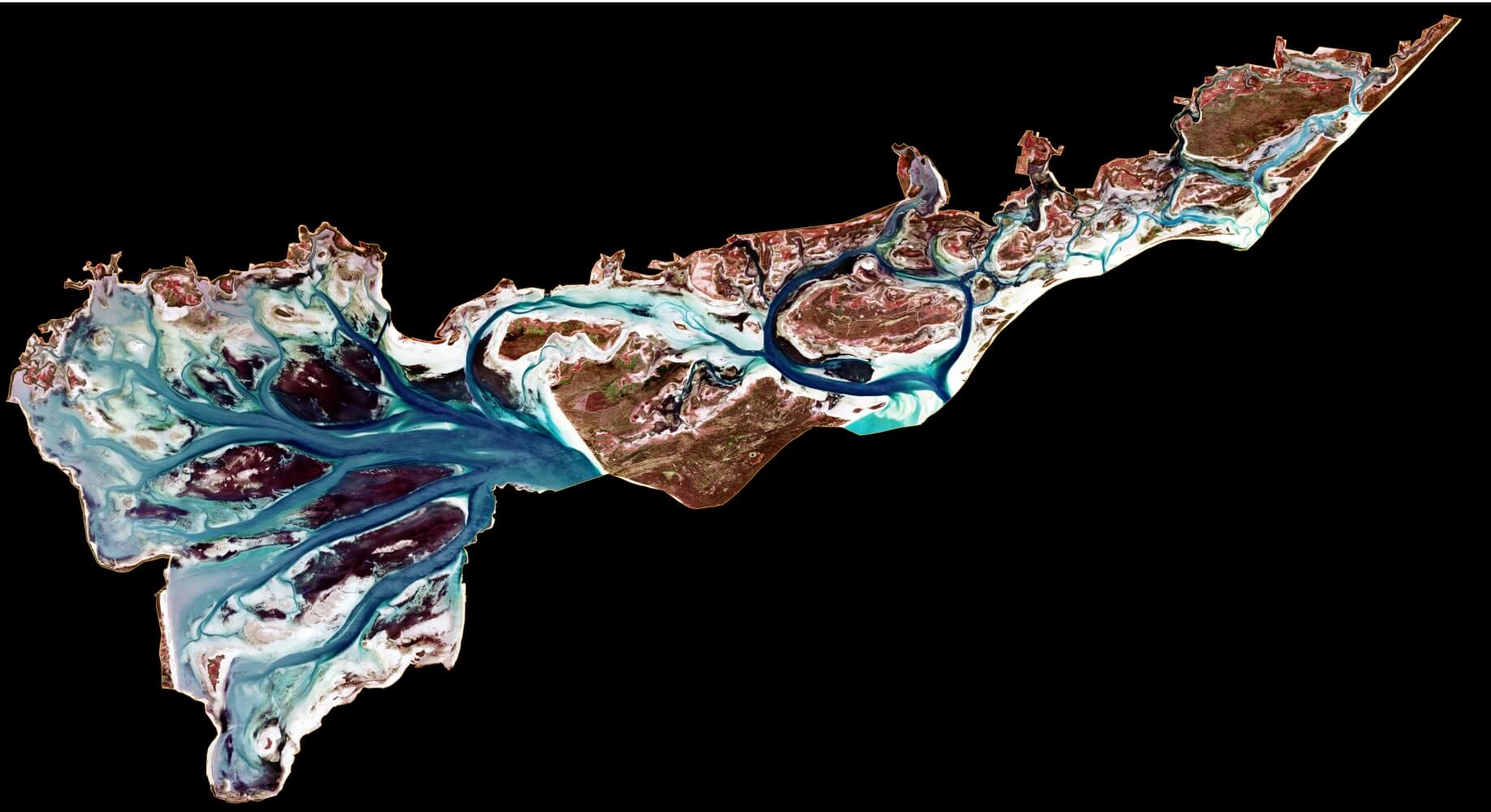
Seagrass mapping from Sentinel-2 at Ramsar sites
Seagrass is an important component of a number of Victoria's shallow water embayments that are listed by the Australian Government as wetlands of international importance:
- The Port Phillip (Western Shoreline) and Bellarine Peninsula Ramsar Site
- The Corner Inlet Ramsar Site
- The Gippsland Lakes Ramsar Site
Simple maximum likelihood classification of Sentinel-2 imagery has provided a cost effective way to monitor seasonal and inter-annual shifts in seagrass extent at these sites. It does require clear skys and water!
Project Details...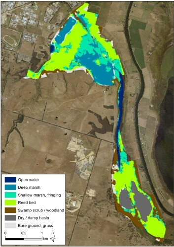
Mapping wetland vegetation from Sentinel-2 satellite imagery
Sentinel-2 satellite imagery was used to map freshwater wetland vegetation and saltmarsh across the Gippsland Lakes Ramsar Site in Victoria, Australia.
Supervised maximum likelihood classification models were trained in ArcGIS to identify different land cover types in the imagery.
The mapping was an efficient and cost-effective way to quantify the extent of aquatic habitats that have been identified as critical to the ecological character of the Gippsland Lakes Ramsar site. We were then able to evaluate the current status of ecological character by comparing the mapped extent to the extents defined in the Limits of Acceptable Change (LAC) for the Ramsar Site.
Fun fact: we call Macleod Morass (pictured) "the Sea Horse" 😀
Project Details...