Mapping wetland vegetation from Sentinel-2 satellite imagery
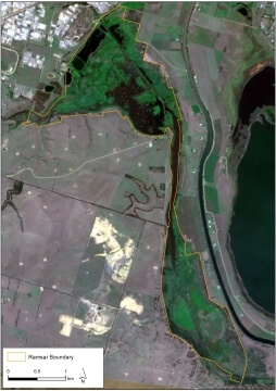
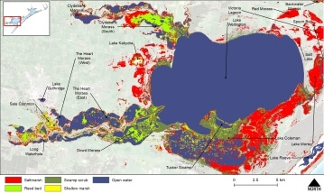
Sentinel-2 satellite imagery was used to map freshwater wetland vegetation and saltmarsh across the Gippsland Lakes Ramsar Site in Victoria, Australia.
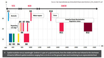
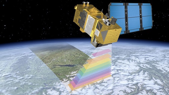
The Sentinel-2 program of the European Space Agency (ESA) uses two satellites (Sentintel-2A launched June 2015 and 2B launched March 2017). Together they map the earth providing high spatial resolution imagery (10 m to 60 m pixels) with a combined return interval of 5 days.
This typically provides at least one cloud-free view of the Gippsland Lakes every 6 months suitable for mapping current terrestrial vegetation or shallow water habitats.
Each satellite has a multi-spectral sensor for wavelengths that are suited for water, vegetation and soils mapping.
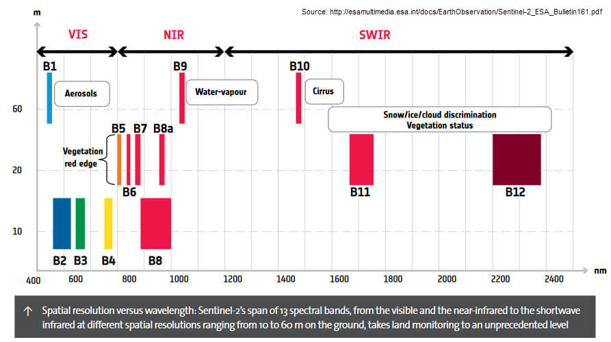
Image classification uses the information in the many wavelength bands to classify the spectral signature of the reflectance from different surfaces. Water, vegetation, soils, and urban areas each reflect light in different ways and the unique reflectance fingerprint can be used to map their distribution in satellite imagery. Vegetation absorbs red light and reflects infrared enabling combinations of wavelengths to distinguish different vegetation types. In contrast, water absorbs infrared, so water will appear black to an infrared camera.
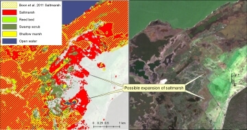
Satellite images were screened by viewing on the National Map web site to select cloud free viewing dates in June-September when tall marsh had browned off for the winter making it easier to distinguish from green vegetation.
Images were pre-processed using the Sentinel Application Platform (SNAP) 8.0 to extract wavelength bands, calculate NDVI and mask water and land areas. The third party sen2res plugin for SNAP was used to “super-sample” the lower spatial resolution infrared bands from 20m to 10m (Brodu 2017 and here).
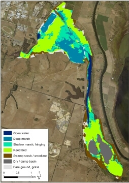
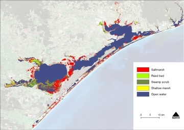
For mapping wetland vegetation a composite image was created using the Sentinel-2 visible, red-edge, near and short wave infrared (Bands 1, 2,3,4,5,6,7,8,11). NDVI (Normalized Difference Vegetation Index) was calculated and added as an additional band to help distinguish green vegetation (swamp scrub and sedgelands) from non-green vegetation (senesced tall marsh, Sarcocornia saltmarsh) or from bare ground.
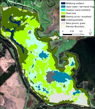
Supervised maximum likelihood classification models were trained in ArcGIS to identify different land cover types in the imagery.
- Saltmarsh
- Tall marsh (reed beds)
- Shallow marsh, wet ground
- Swamp scrub
- Coastal scrub/heathlands
- Agricultural land
- Forest
- Bare ground (includes roads and rooftops)
- Open water
The terrestrial land cover classes are not of interest but are included to give the classifier bins in which to allocate the areas that are not fresh or saline marshes or swamp scrub.
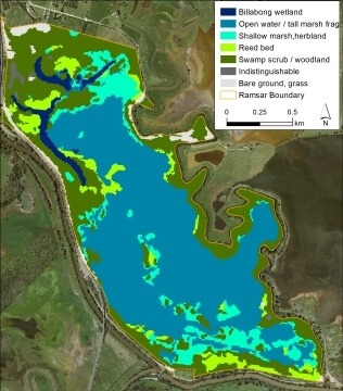
The mapping was an efficient and effective way to quantify the extent of aquatic habitats that have been identified as critical to the ecological character of the Gippsland Lakes Ramsar site. We were then able to evaluate the current status of ecological character by comparing the mapped extent to the extents defined in the Limits of Acceptable Change (LAC) for the Ramsar Site. The critical wetland extents were within the acceptable limits.
More information:
Sean Phillipson, Jennifer Hale and Shane Brooks (2021). A birds eye view: Using remotely sensed data to monitor Limits of Acceptable Change in the Gippsland Lakes Ramsar Site. Proceedings of the 10th Australian Stream Management Conference, pp36-43  Paper (552kB)
Client: East Gippsland Catchment Management Authority
All maps copyright © Shane Brooks 2021