Projects
A window into some of the projects I lead or contribute to.

Long-Term Monitoring Data: Murray-Darling Basin
The Flow Monitoring, Evaluation and Research program (Flow-MER) monitors environmental outcomes from Commonwealth environmental water management in the Murray-Darling Basin.
Annual monitoring data from 2014 onwards are published openly to Data.gov.au building a valuable public resource of long-term species and environmental data.
Project Details...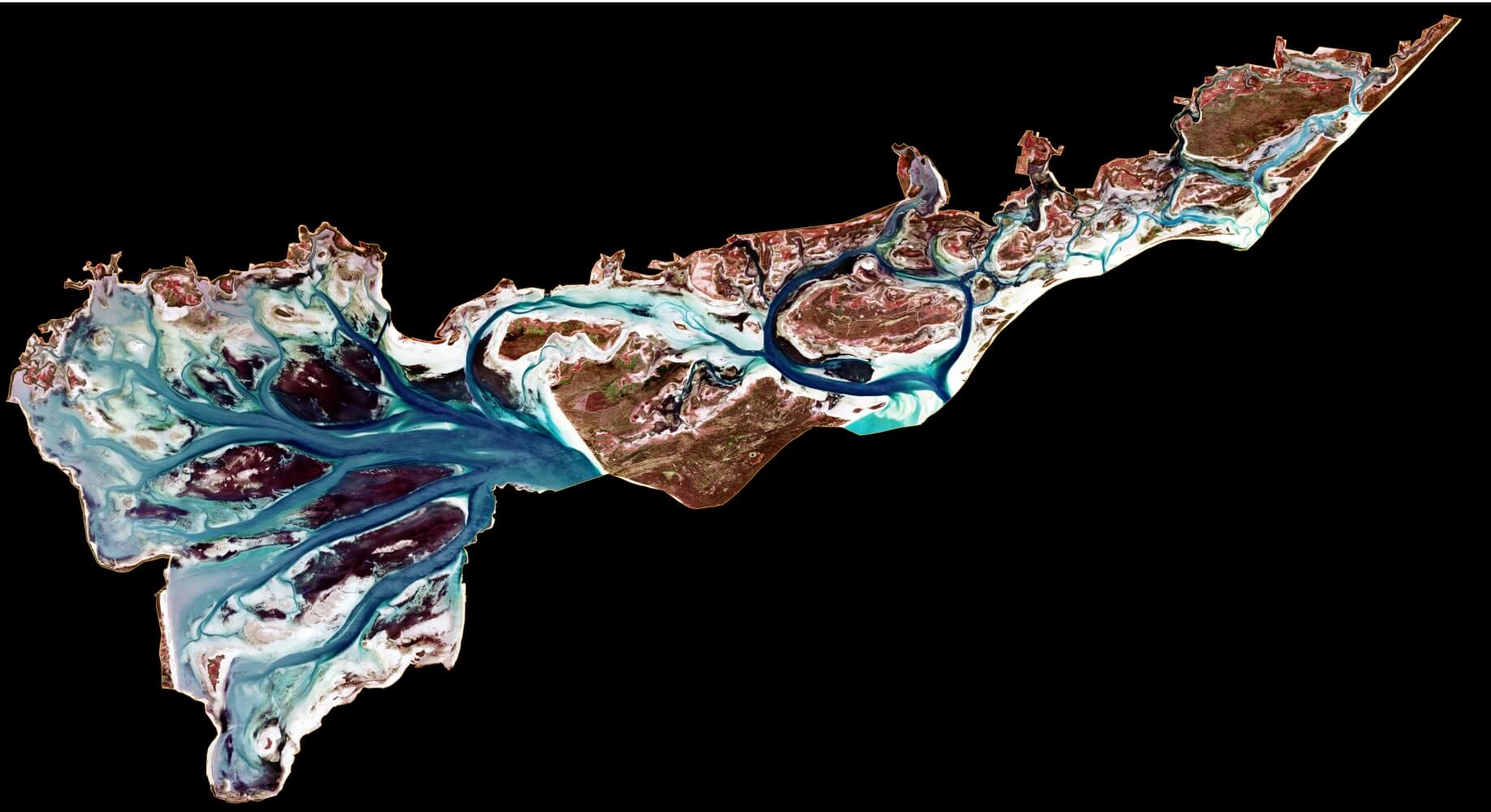
Seagrass mapping from Sentinel-2 at Ramsar sites
Seagrass is an important component of a number of Victoria's shallow water embayments that are listed by the Australian Government as wetlands of international importance:
- The Port Phillip (Western Shoreline) and Bellarine Peninsula Ramsar Site
- The Corner Inlet Ramsar Site
- The Gippsland Lakes Ramsar Site
Simple maximum likelihood classification of Sentinel-2 imagery has provided a cost effective way to monitor seasonal and inter-annual shifts in seagrass extent at these sites. It does require clear skys and water!
Project Details...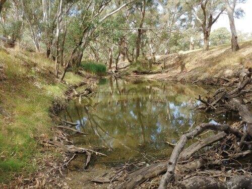
Monitoring and Research (Flow-MER) Project
Flow-MER is the Commonwealth Environmental Water Office (CEWO) on-ground monitoring, evaluation and research program. The CEWO works in partnership with scientists across the Murray-Darling Basin to help understand how fish, birds, vegetation and river connectivity are responding to environmental watering.
I am the Ecosystem Diversity theme leader in the Basin-scale team. The Ecosystem Diversity evaluation identifies the number and types of river, estuary, wetland and floodplain ecosystems that are supported by Commonwealth environmental water management actions.
Over the 8-year period 2014–22, Commonwealth environmental water has supported 59 different ecosystem types representing 92% of the ecosystem diversity on the managable floodplain that is mapped by the Australian National Aquatic Ecosystem (ANAE) classification of the Basin.
Project Details...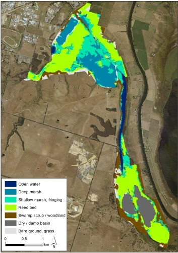
Mapping wetland vegetation from Sentinel-2 satellite imagery
Sentinel-2 satellite imagery was used to map freshwater wetland vegetation and saltmarsh across the Gippsland Lakes Ramsar Site in Victoria, Australia.
Supervised maximum likelihood classification models were trained in ArcGIS to identify different land cover types in the imagery.
The mapping was an efficient and cost-effective way to quantify the extent of aquatic habitats that have been identified as critical to the ecological character of the Gippsland Lakes Ramsar site. We were then able to evaluate the current status of ecological character by comparing the mapped extent to the extents defined in the Limits of Acceptable Change (LAC) for the Ramsar Site.
Fun fact: we call Macleod Morass (pictured) "the Sea Horse" 😀
Project Details...
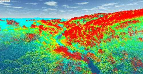
Riparian LiDAR change assessment and river mapping
This project is mapping river banks, the channel and riparian vegetation in GIS from aerial LiDAR data collected by Victoria's Department of Land, Water and Planning (DELWP).
LiDAR stands for Light Detection and Ranging. An aircraft mounted laser scans the landscape measuring the distance to the ground. Vegetation cover and structure is captured in the laser reflections that are above the ground.
Project Details...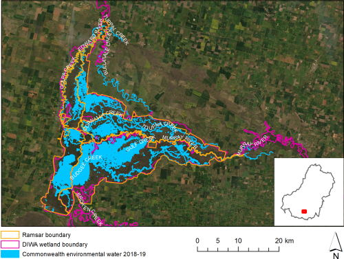
CEWO Long-Term Intervention Monitoring (LTIM) Project
LTIM examines the contribution of Commonwealth environmental water to the environmental objectives of the Murray-Darling Basin Plan, while assisting the CEWO to demonstrate environmental outcomes and adaptively manage the water holdings.
I lead the Ecosystem Diversity evaluation for the Basin-scale evaluation team and manage the data collected by the project for the CEWO.
Project Details...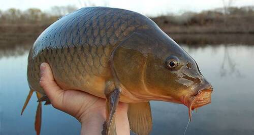
Carp Biomass Estimate and Population Model
Teaming up with the Arthur Rylah Institute for Environmental Research and state fisheries scientists I provided spatial mapping and habitat area estimates to model the biomass of carp and carp population dynamics.
These two modelling projects contributed to the National Carp Control Plan's assessment of feasibility of using Cyprinid herpesvirus 3 as a biological control agent for introduced common carp in Australia.
Project Details...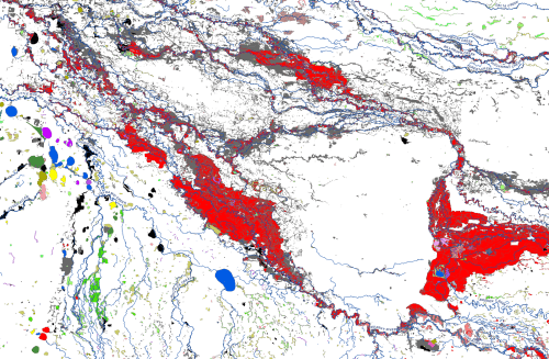
The Australian National Aquatic Ecosystems (ANAE) classification of the Murray-Darling Basin
The Australian National Aquatic Ecosystem (ANAE) classification of the Murray-Darling Basin was developed to provide consistent cross-jurisdictional support for adaptive management of aquatic ecosystems with specific relevance to the management of Commonwealth environmental water.
The ANAE classification integrates the best available mapping data combined with simple rules to define ecosystem types using a small number of relevant attributes (e.g. water regime, water source, salinity, landform and dominant vegetation).
v3.0 released in 2021! The mapping of the ANAE classification of the Murrray-Darling Basin is now considered to be ‘complete’ for the Basin, representing the best available mapping for all jurisdictions.
Project Details...
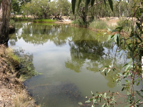
Environmental Water Contribution to Ecosystem Functions and Resilience in the Wimmera River
Environmental water releases in the Wimmera River have helped “hold the line” against dry conditions by topping up pool levels, reducing salinity, and improving water clarity. This has allowed proliferation of submerged and emergent macrophytes that increase habitat values for fish, macroinvertebrates and waterbirds.
Project Details...