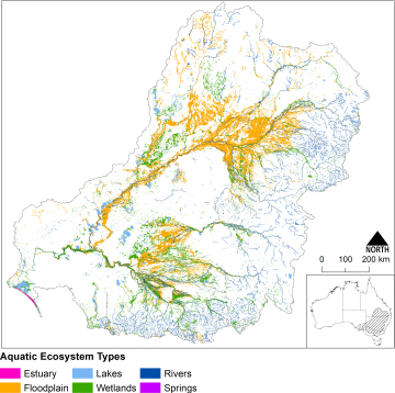
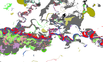
The Australian National Aquatic Ecosystems (ANAE) classification of the Murray-Darling Basin
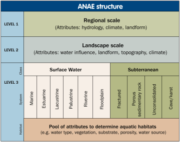
The Australian National Aquatic Ecosystem (ANAE) classification of the Murray-Darling Basin was developed to provide consistent cross-jurisdictional support for adaptive management of aquatic ecosystems with specific relevance to the management of Commonwealth environmental water. The ANAE classification integrates the best available mapping data combined with simple rules to define ecosystem types using a small number of relevant attributes (e.g. water regime, water source, salinity, landform and dominant vegetation).
The classification is currently used by the Murray-Darling Basin Authority (MDBA) and Commonwealth Environmental Water Office (CEWO) to support monitoring, evaluation and adaptive management of water resources in the Basin.
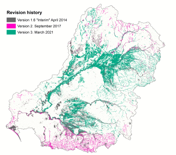
ANAE Classification of the Murray-Darling Basin v3.0 released
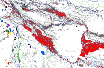
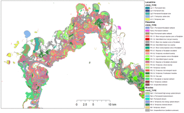
In 2021 a new update was released as v3.0 which dramatically improves the mapping of floodplain systems and completes the mapping in western NSW. The update also includes improvements to river mapping using the new Australian Hydrological Geospatial Fabric (Geofabric) v3. The mapping of the ANAE classification of the Murrray-Darling Basin is now considered to be ‘complete’ for the Basin, representing the best available mapping for all jurisdictions. As part of the v3.0 update I have written a User Guide that attempts to consolidate reference information and provide helpful hints and approaches for working with the data set.
All the data is published for open access under the Creative Commons Attribution 4.0 International Licence
Clients: the Murray-Darling Basin Authority (MDBA) and Commonwealth Environmental Water Office (CEWO) supported by the Basin States.
More Information:
- Download the ANAE v3 GIS data sets:
- Wetlands (shapefile) 735 MB
- Waterways (shapefile) 111 MB
- Complete ANAEv3 Geodatabase 2 GB (includes the wetlands and rivers)
 ANAE classification of the Murray-Darling Basin v3.0 User Guide 18Mar2021.pdf
- ANAE v3.0 Update Technical Report 18Mar2021.pdf
- ANAE v3.0 release presentation (pdf of powerpoint slides)
- The Aquatic Ecosystems Toolkit Module 2: Interim Australian National Aquatic Ecosystem (ANAE) Classification Framework
- Brooks, S. (2017). Classification of aquatic ecosystems in the Murray-Darling Basin: 2017 update. Report to the Murray-Darling Basin Authority and Commonwealth Environmental Water Office, Canberra.
- Brooks S., Cottingham P., Butcher R. and Hale J. (2014). Interim Classification of Aquatic Ecosystems in the Murray-Darling Basin (2014). Peter Cottingham & Associates report to the Commonwealth Environmental Water Office and Murray-Darling Basin Authority, Canberra.