Rivers
A window into some of the projects I lead or contribute to.
Monitoring and Research (Flow-MER) Project
Flow-MER is the Commonwealth Environmental Water Office (CEWO) on-ground monitoring, evaluation and research program. The CEWO works in partnership with scientists across the Murray-Darling Basin to help understand how fish, birds, vegetation and river connectivity are responding to environmental watering.
I am the Ecosystem Diversity theme leader in the Basin-scale team. The Ecosystem Diversity evaluation identifies the number and types of river, estuary, wetland and floodplain ecosystems that are supported by Commonwealth environmental water management actions.
Over the 8-year period 2014–22, Commonwealth environmental water has supported 59 different ecosystem types representing 92% of the ecosystem diversity on the managable floodplain that is mapped by the Australian National Aquatic Ecosystem (ANAE) classification of the Basin.
Project Details...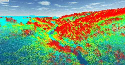
Riparian LiDAR change assessment and river mapping
This project is mapping river banks, the channel and riparian vegetation in GIS from aerial LiDAR data collected by Victoria's Department of Land, Water and Planning (DELWP).
LiDAR stands for Light Detection and Ranging. An aircraft mounted laser scans the landscape measuring the distance to the ground. Vegetation cover and structure is captured in the laser reflections that are above the ground.
Project Details...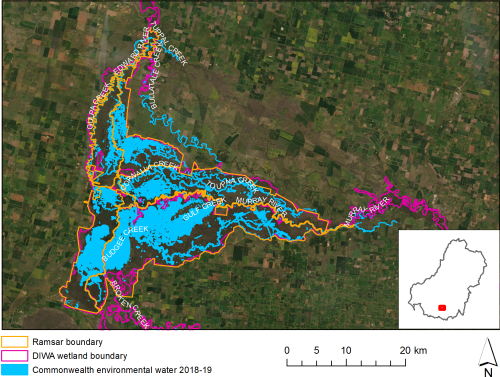
CEWO Long-Term Intervention Monitoring (LTIM) Project
LTIM examines the contribution of Commonwealth environmental water to the environmental objectives of the Murray-Darling Basin Plan, while assisting the CEWO to demonstrate environmental outcomes and adaptively manage the water holdings.
I lead the Ecosystem Diversity evaluation for the Basin-scale evaluation team and manage the data collected by the project for the CEWO.
Project Details...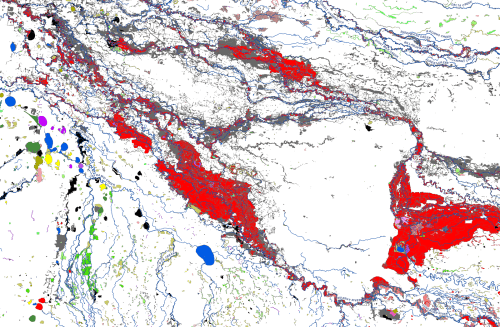
The Australian National Aquatic Ecosystems (ANAE) classification of the Murray-Darling Basin
The Australian National Aquatic Ecosystem (ANAE) classification of the Murray-Darling Basin was developed to provide consistent cross-jurisdictional support for adaptive management of aquatic ecosystems with specific relevance to the management of Commonwealth environmental water.
The ANAE classification integrates the best available mapping data combined with simple rules to define ecosystem types using a small number of relevant attributes (e.g. water regime, water source, salinity, landform and dominant vegetation).
v3.0 released in 2021! The mapping of the ANAE classification of the Murrray-Darling Basin is now considered to be ‘complete’ for the Basin, representing the best available mapping for all jurisdictions.
Project Details...
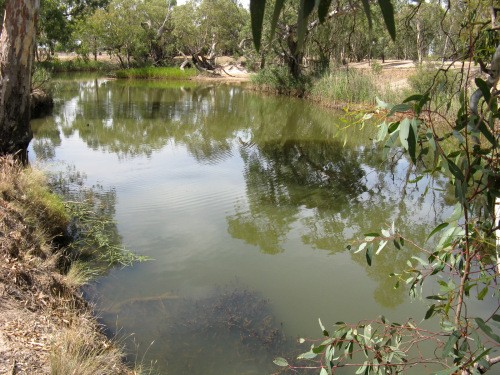
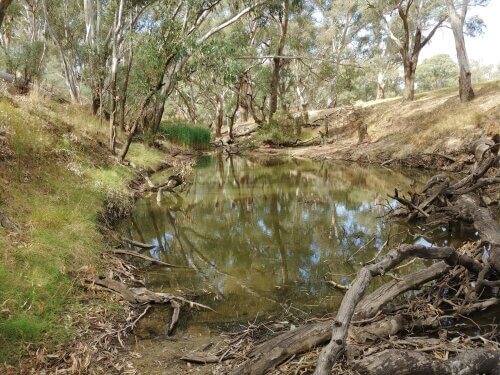
Environmental Water Contribution to Ecosystem Functions and Resilience in the Wimmera River
Environmental water releases in the Wimmera River have helped “hold the line” against dry conditions by topping up pool levels, reducing salinity, and improving water clarity. This has allowed proliferation of submerged and emergent macrophytes that increase habitat values for fish, macroinvertebrates and waterbirds.
Project Details...