Riparian LiDAR change assessment and river mapping
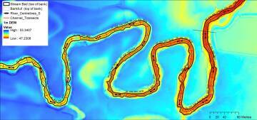
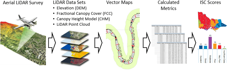
This project is mapping river banks, the channel and riparian vegetation in GIS from aerial LiDAR data collected by Victoria's Department of Land, Water and Planning (DELWP).
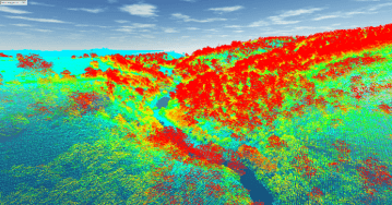
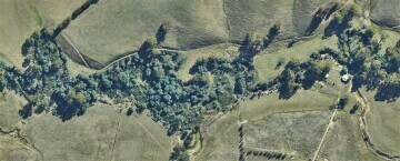
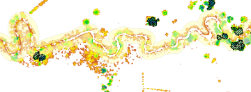
LiDAR stands for Light Detection and Ranging. An aircraft mounted laser scans the landscape measuring the distance to the ground. Vegetation cover and structure is captured in the reflections that are above the ground.
Aerial LiDAR was first used by DELWP to map river channels and riparian vegetation for the Victorian Index of Stream Condition program in 2009/10. New capture in 2018/19 allows DELWP and CMAs to quantify a decade of change in river channels and riparian vegetation. This provides an exciting opportunity to look at management outcomes against a backdrop of natural change after floods, bush-fires, and drought.
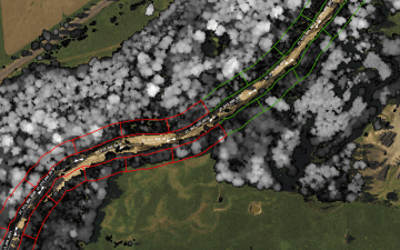
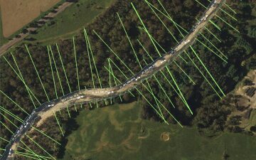
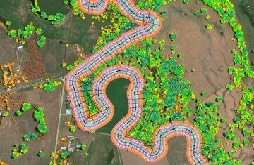
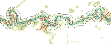
For this project I developed work-flow and GIS automation tools for DELWP to process the LiDAR data into river line maps and vegetation metrics calculated for different riparian buffers.
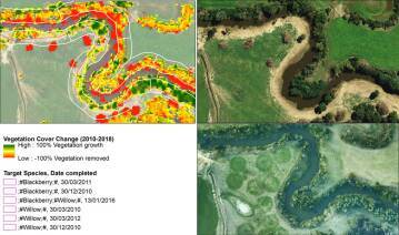
Vegetation metrics include:
- Fractional canopy cover
- Canopy height
- Large Trees (Trees exceeding a defined height and crown area based on EVC benchmarks)
- Tree Cover
- Understorey Cover
- Structure (number of strata)
- Overhang (shading of the river channel)
- Fragmentation (gaps in woody vegetation greater than 10 x 10m)
- Riparian vegetation Width
Repeatability is a major consideration. Firstly, to ensure differences among times in derived metrics can confidently be ascribed to real-world change not differences in data processing. Secondly, to ensure consistent processing of different capture seasons to build trajectories of change through time.
Client: DELWP